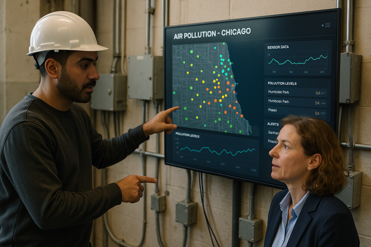
Introduction to Chicago's Neighborhood Air Quality Map
On March 12, 2026, The Chicago Reporter published a comprehensive air pollution map showing varying air quality levels across neighborhoods in Chicago. This map aggregates data from multiple sensors distributed throughout the city, providing granular insights into pollution hotspots and trends. Such transparency is crucial for residents and city officials aiming to mitigate health risks associated with poor air quality.
The Role of Real-Time Sensing and Data Integration
The map leverages real-time air quality sensors, which continuously collect environmental data such as particulate matter, nitrogen oxide levels, and ozone concentrations. Integrating these sensors into a unified platform enables the building of live dashboards that visually represent pollution levels by neighborhood. This timely information supports environmental agencies and businesses in monitoring air quality dynamically rather than relying on intermittent, less frequent readings.
Automated Alerts and Operational Response
Real-time data feeds into automated alert systems that notify stakeholders when air quality deteriorates beyond safe thresholds. These alerts enable rapid operational decisions, such as adjusting industrial emissions, modifying traffic flows, or issuing public health advisories. For organizations tasked with environmental compliance and public safety, having immediate awareness facilitates proactive measures rather than reactive ones, potentially reducing exposure and improving outcomes.
Implications for Businesses and City Agencies
Access to precise air quality data can transform how businesses and governmental bodies respond to environmental challenges. Industries can optimize operations to minimize emissions during sensitive periods, while city authorities can allocate resources more effectively to address pollution sources. Such data-driven approaches also enhance community relations by demonstrating commitment to transparency and public health.
How Paw Partners Supports Environmental Data Solutions
Implementing and managing integrated air quality sensing networks and automated alert systems require specialized engineering expertise. Paw Partners offers tailored solutions that combine sensor deployment, data integration, and custom dashboard development, ensuring organizations have reliable, actionable information at their fingertips. By partnering with Paw Partners, stakeholders can enhance their environmental monitoring capabilities and improve operational decisions in response to Chicago’s air quality challenges.